Pegase Application : Flanders (Be)
| Year of design: | 2008 |
|---|
| Description: | A first collaboration between VlaamseMilieuMaatschappij (VMM) and Aquapole (former CEME) occurred between 1994 and 1997 in the frame of a European LIFE projet to apply the Pegase model to the trans-national basin of the Scheldt
(in collaboration with Walloon Region and French Water Agency Artois-Picardie).
This collaboration carried on with several applications:
- a pilot application on the flemish part of the Scheldt watershed. This application, realised between 2001 and 2004, modelled (including a few waloon rivers upstream flemmish rivers) 620 rivers for 5 970 km and 11 455 km² of watershed ;
- an application specifically dedicated to the network of canals linking the basin of the Meuse to the basin of the Scheldt (2003-2006);
- an application o the flemmish part of the Scheldt basin (with an extension towards the system of canals draining some of the water directly to the north sea), responding to the requirements of the European water Framework directive.
This application, realised in 2007/2008 modelled 706 water courses( 37 canals and "junctions") for 6 870 km of rivers
- In the frame of the trans-national modelling of the Meuse basin, a specific application has been realised on the flemmish part of the basin.
this application, realised between 2009 and 2010 modelled 65 water courses, 550 km of river and 1 825 km² of watershed.
|
|---|
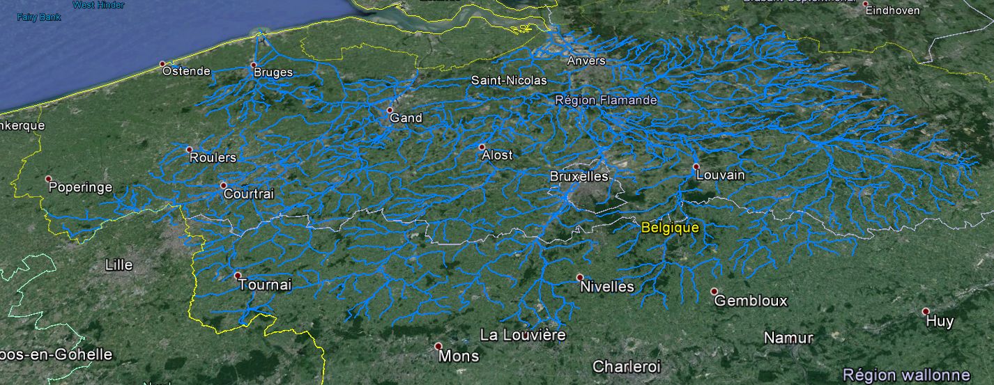
| Basin View*: | 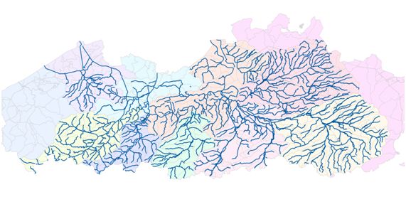
 |
|---|
| Competent Authority: | Vlaamse Milieumaastschappij |
|---|
| Watershed: | 13151 km2 |
|---|
| Rivers: | 706 (6870 km) |
|---|
| Pegase Nodes: | 36000 |
|---|
| History: | Current Basin
|
|---|
* Images realised with Google-Earth™ and ArcGIS™